TITLE: Chapada Diamantina, an unique place, a remarkable landscape.
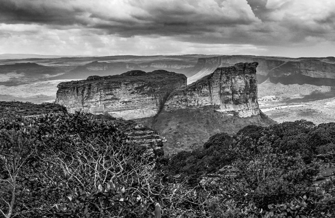
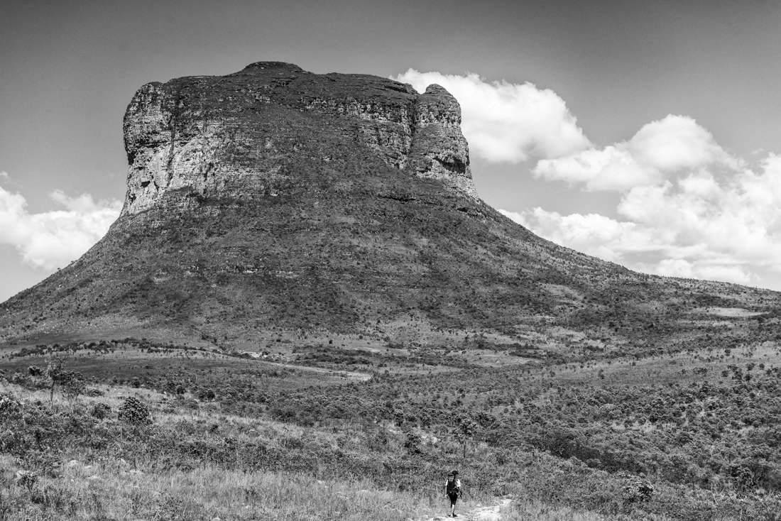
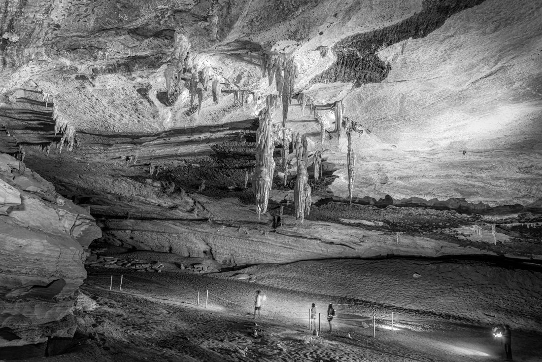
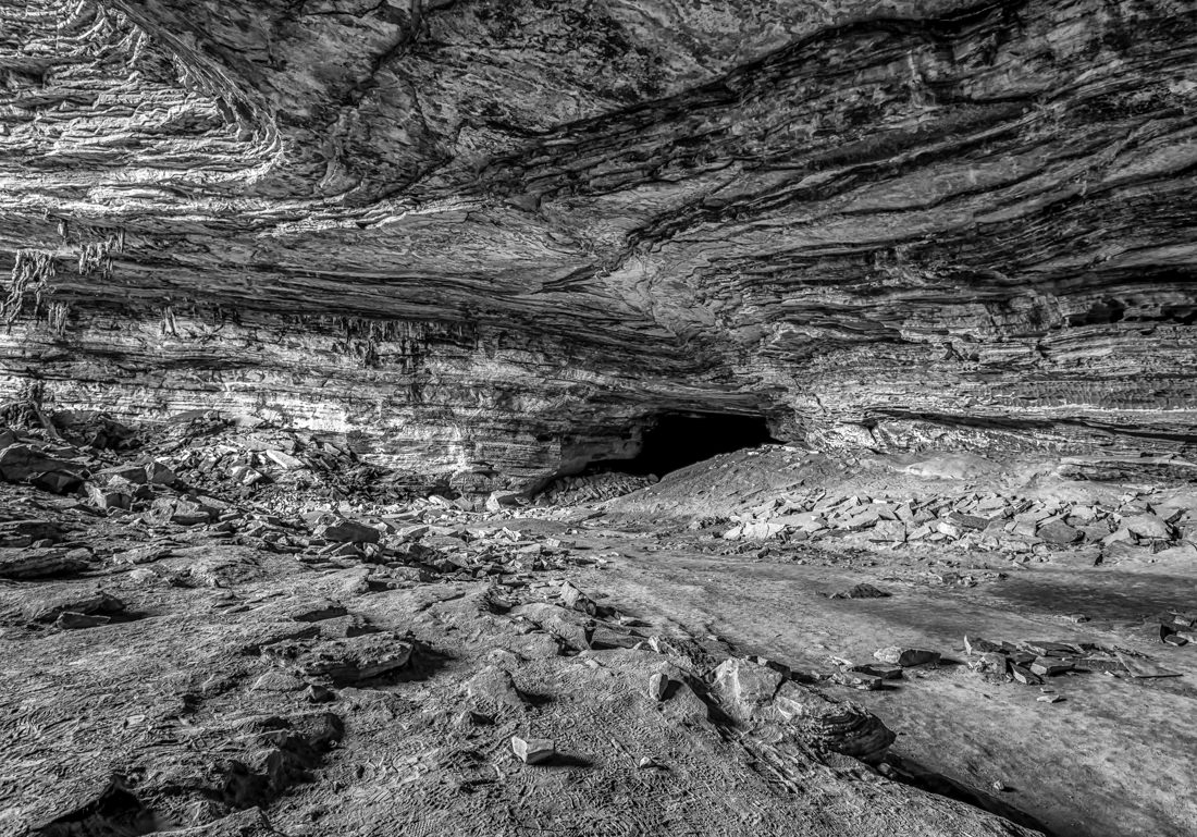
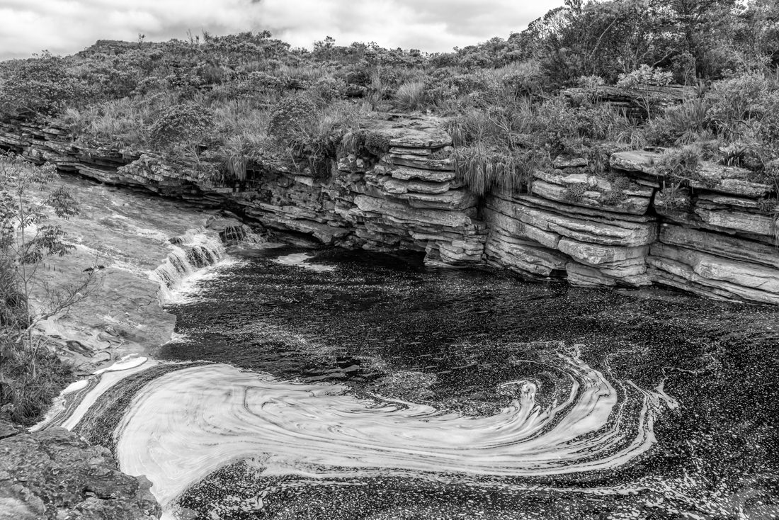
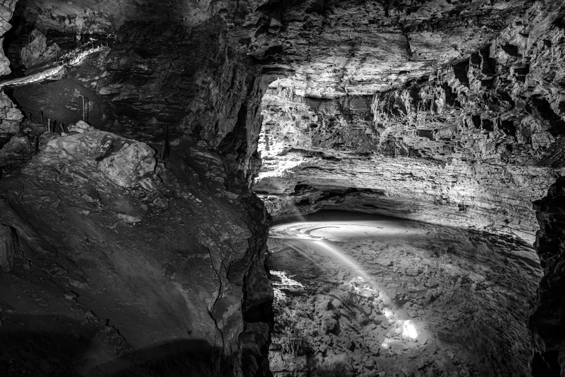
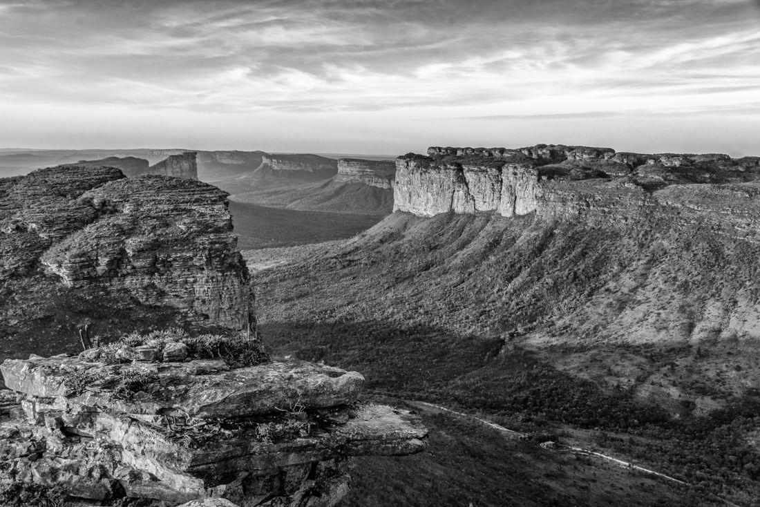
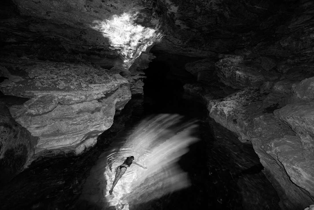
One of the most beautiful Brazilian landscapes is not on the famous coastline or in the immeasurable Amazon forest. It is in the interior of the country and is called Chapada Diamantina. The Chapada Diamantina lies at the center of Bahia State, in Brazil. It has approximately 38,000 km2 (15,000 sq mi) and encompasses 58 municipalities. Chapada Diamantina is an erosional landform and runs from North to South in the middle of the State. The rocks in the system date back to Pangaea and erosion of the formation began in the Precambrian eon. This region is marked by mountainous relief with pronounced scarps, deep valleys, and high plateaus. This arrangement, combined with the current fluvial system, has resulted in a relief marked by flattop elevations that reach over 1,800 m in altitude. Two major geomorphological domains are observed at Chapada Diamantina. The karstic domain is dominated by flat relief and slightly undulating terrain. The main features include collapse sinkholes and caves that extend into galleries for up to tens of kilometers. An unique place, a remarkable landscape.
AUTHOR: ANDRE MOTTA DE SOUZA (Brazil)
I have been a Corporate Photographer for the past 10 years, and have registered numerous executives in the Energy segment in Brazil. I am a Specialist in Digital Asset Management, with a strong emphasis on Metadata and Taxonomy. This made me responsible for the Image Collection of Petrobras, the largest Brazilian company, with a collection of over 200,000 images. My work as a Petrobras photographer illustrates some textbooks, commemorative books from partner companies and Petrobras itself, as well as publication in magazines in the oil and energy sector. Retired, I am currently creating abstract images and I have fun making portraits and also photographing nature in the small town I moved to in the interior of Brazil.
SHARE
Support this photographer - share this work on Facebook.